Boundaries
Parcel-accurate jurisdiction boundary tables — the data that makes every other sales tax system more accurate.
US Navy veteran-owned. Patent pending.
The problem with jurisdiction boundaries
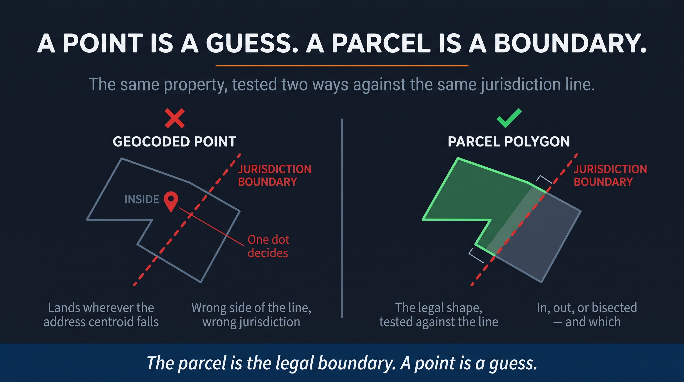
Every sales tax system — every calculation engine, every returns processor, every audit tool — depends on jurisdiction boundary data. Which taxing authority governs this address? Which rate applies?
The industry standard is a point-in-polygon approximation: drop a single coordinate into a ZIP code and test whether it falls inside a jurisdiction boundary. When a property line crosses a taxing boundary — and many do — a point on one side of the line produces the wrong rate. Every transaction at that address is wrong. Every return that includes that transaction is wrong. Every audit finding derived from that return is wrong.
Patent-pending Cadastral Situs Resolution replaces the approximation with deterministic geometry. Every address is resolved to the actual cadastral parcel — the legal boundary of the property. The parcel polygon is tested against the jurisdiction boundary polygon. The result is in, out, or bisected — with each jurisdiction’s own rule for split parcels applied. No point. No guess. No wrong side of the line.
The product
For state revenue agencies
Replace your current jurisdiction boundary tables — street segments, ZIP+4 ranges, whatever you use today — with parcel-accurate polygon data. Every address in your state deterministically assigned to its taxing jurisdiction. Improves the accuracy of every calculation, return, and audit your state processes.
For sales tax providers
License parcel-accurate jurisdiction tables for your calculation engine. Drop-in over your current boundary data, behind the API shape you already publish — no change your customers have to integrate against, with parcel-level accuracy underneath. Your customers get more accurate rates. You get a defensible data story.
For auditors
When your state upgrades to parcel-accurate boundaries, every CensusAudit determination gains an additional layer of precision: not just what the statute says about the product, but exactly which jurisdiction the transaction falls in — to the parcel, to the boundary line, with the citation attached.
How it works
Every cadastral parcel polygon in the state is tested against every jurisdiction boundary polygon. The result is a deterministic lookup table: for every address, which jurisdiction — in, out, or bisected. Generated once, verified, and updated as boundaries change. The same data that makes CensusAudit’s Cadastral Situs Resolution possible, available as standalone tables.
When to upgrade
Most states run audits with their own jurisdiction assignment data — street-level, ZIP+4, whatever your auditors use today. That is the safe harbor, and CensusAudit’s audit product runs on your data, not ours. You do not need parcel-accurate boundaries to run a census audit.
But if your state wants to improve its jurisdiction assignment — reducing the rate errors that generate taxpayer appeals and erode audit findings — parcel-accurate boundary tables are available as a separate product. The same data that powers the patent-pending parcel spine, licensed directly to your state or to your sales tax providers.
See the difference
If you administer jurisdiction boundary data for a state or operate a sales tax calculation engine, a comparison dataset is available.
Request a sample